Aerobiologist
Aerology Research Scholar (PhD)
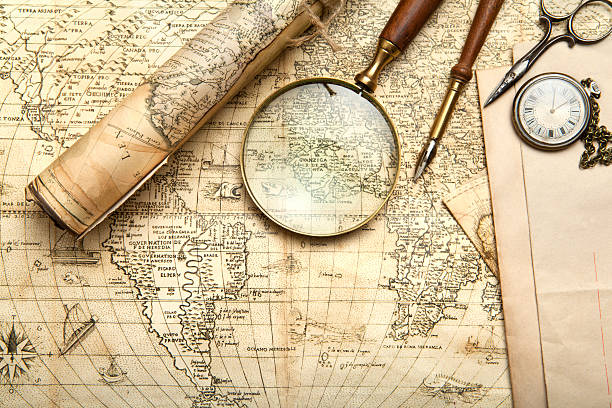
Explore CareerA Cartographer is a professional who designs, creates, and interprets maps to represent geographical, environmental, or cultural data, using scientific, artistic, and technological skills. They work in government agencies, private mapping firms, environmental organizations, or technology companies, collaborating with geographers, surveyors, and data scientists. Cartographers play a crucial role in urban planning, disaster management, navigation, and resource exploration by providing accurate spatial information in a field driven by precision, innovation, and digital transformation.
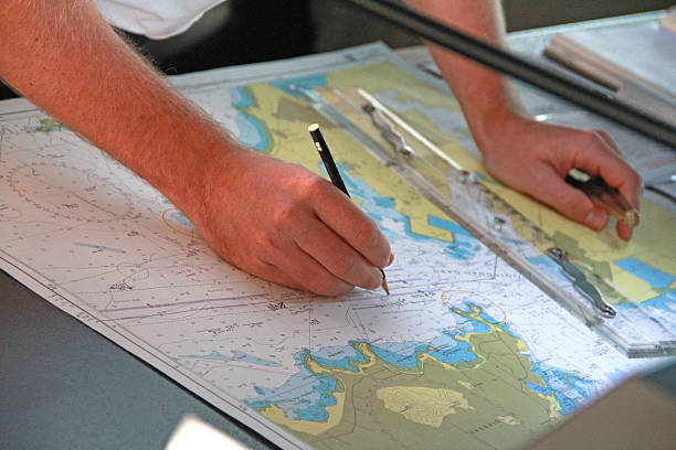
Cartographers are detail-oriented and tech-savvy professionals who work in office environments, field settings, or remote sensing labs, using tools such as Geographic Information Systems (GIS), remote sensing software, and drones. Their role involves collecting spatial data, designing maps for various purposes like navigation or climate analysis, and addressing challenges such as data accuracy or evolving user needs. They combine expertise in geography, computer science, and design to visualize complex spatial relationships. As key contributors to planning and decision-making, they help shape the future of infrastructure, environmental conservation, and public safety in an industry increasingly driven by digital mapping, big data, and geospatial technologies.
| Route | Steps |
| Route 1 |
1. 10+2 in Science stream (with Geography, Mathematics, or Computer Science preferred) 2. Bachelor’s degree in Geography, Cartography, or Geomatics (3-4 years) 3. Internship or assistant role in mapping or GIS projects 4. Practice as Junior Cartographer or GIS Technician |
| Route 2 |
1. 10+2 in Science or Arts stream with Geography 2. Bachelor’s degree in Geography or Environmental Science (3-4 years) 3. Master’s degree in Cartography or Geospatial Science (1-2 years) 4. Gain practical experience through GIS projects 5. Work as Cartographer or GIS Analyst |
| Route 3 |
1. 10+2 in Science with Mathematics or Computer Science 2. B.Tech in Geoinformatics or Civil Engineering with GIS focus (4 years) 3. Certification or short-term course in GIS and Remote Sensing (3-6 months) 4. Internship in mapping or tech firms 5. Practice as Geospatial Specialist or Cartographic Technician |
| Route 4 |
1. 10+2 in Science or Arts stream 2. Bachelor’s degree in Geography or related field (3-4 years) 3. Ph.D. in Cartography or Geospatial Science (3-5 years) 4. Post-doctoral research or consultancy role 5. Practice as Senior Cartographer or Research Consultant |
| Institute | Course/Program | Official Link |
| Indian Institute of Remote Sensing (IIRS), Dehradun | Certificate/M.Tech in Remote Sensing & GIS | https://www.iirs.gov.in/ |
| University of Delhi, Delhi | B.A./M.A. in Geography with Cartography | https://www.du.ac.in/ |
| Jawaharlal Nehru University (JNU), New Delhi | M.A./Ph.D. in Geography with GIS focus | https://www.jnu.ac.in/ |
| Banaras Hindu University (BHU), Varanasi | B.A./M.A. in Geography with Cartography | https://www.bhu.ac.in/ |
| University of Hyderabad, Hyderabad | M.Sc in Geoinformatics | https://www.uohyd.ac.in/ |
| Anna University, Chennai | B.E./M.E. in Geoinformatics | https://www.annauniv.edu/ |
| Symbiosis Institute of Geoinformatics, Pune | M.Sc in Geoinformatics | https://www.sig.ac.in/ |
| Indian Institute of Technology (IIT), Bombay | M.Tech in Geoinformatics & Natural Resources | https://www.iitb.ac.in/ |
| University of Madras, Chennai | M.Sc in Geography with GIS | https://www.unom.ac.in/ |
| Osmania University, Hyderabad | M.Sc in Geography with Cartography focus | https://www.osmania.ac.in/ |
| Institution | Course | Country | Official Link |
| University of Wisconsin-Madison | BS/MS in Cartography and GIS | USA | https://www.wisc.edu/ |
| University College London (UCL) | MS/Ph.D. in Geospatial Science | UK | https://www.ucl.ac.uk/ |
| University of California, Santa Barbara | BS/MS/Ph.D. in Geography with GIS focus | USA | https://www.ucsb.edu/ |
| University of Toronto | BS/MS in Geography and GIS | Canada | https://www.utoronto.ca/ |
| University of Melbourne | BS/MS in Geospatial Information Science | Australia | https://www.unimelb.edu.au/ |
| Delft University of Technology | MS/Ph.D. in Geomatics | Netherlands | https://www.tudelft.nl/ |
| ETH Zurich | MS/Ph.D. in Geomatic Engineering | Switzerland | https://www.ethz.ch/ |
| National University of Singapore (NUS) | BS/MS in Geography with GIS focus | Singapore | https://www.nus.edu.sg/ |
| University of Copenhagen | MS/Ph.D. in Geoinformatics | Denmark | https://www.ku.dk/ |
| University of Salzburg | MS/Ph.D. in Applied Geoinformatics | Austria | https://www.plus.ac.at/ |
India:
International:
Cartography Intern → Junior Cartographer → GIS Technician → Cartographer → Senior Cartographer → Cartography Project Manager → Director of Geospatial Research → Chief Mapping Officer → Cartography Consultant → Cartography Professor
| India | International |
| Survey of India | Google Maps, Global |
| National Remote Sensing Centre (NRSC) | Esri, Global |
| Indian Space Research Organisation (ISRO) | Apple Maps, Global |
| Geological Survey of India (GSI) | HERE Technologies, Global |
| National Atlas & Thematic Mapping Organisation (NATMO) | TomTom, Global |
| Forest Survey of India (FSI) | Garmin, Global |
| Ministry of Urban Development | Ordnance Survey, UK |
| Central Water Commission (CWC) | National Geographic, USA |
| Indian Institute of Remote Sensing (IIRS) | USGS (United States Geological Survey), USA |
| State Remote Sensing Application Centres | Mapbox, Global |
| Pros | Cons |
| Opportunity to contribute to critical planning and decision-making processes | Often involves repetitive data processing or map updates |
| High personal satisfaction in visualizing complex spatial data for public use | Can face challenges due to data inaccuracies or outdated sources |
| Rewarding impact on urban development, disaster response, and conservation | May require continuous learning to keep up with evolving geospatial tech |
| Diverse career paths across government, industry, and research | Risk of limited job opportunities in traditional cartography roles |
| Strong potential for growth with increasing demand in digital mapping and GIS | Fieldwork may involve travel to remote or challenging locations |
| Career Level | India (₹ per annum) | International (USD per annum) |
| Cartography Intern (Early Career) | 2,00,000 - 4,00,000 | 25,000 - 40,000 |
| Junior Cartographer (Mid-Career) | 4,00,000 - 8,00,000 | 40,000 - 60,000 |
| Cartographer | 8,00,000 - 15,00,000 | 60,000 - 85,000 |
| Senior Cartographer/Project Manager | 15,00,000 - 25,00,000 | 85,000 - 120,000 |
| Chief Mapping Officer/Expert | 25,00,000+ | 120,000+ |
| Note: Salaries may vary based on location, employer, experience, and specialization. |
A career as a Cartographer offers a profound opportunity to visualize the world, driving progress through precise spatial representation and technological expertise, fostering global well-being with every map created. Cartographers are the architects of spatial understanding, using their skills to support urban planning, environmental protection, and disaster response across industries. This profession blends scientific analysis with creative design, providing pathways in government, technology, education, and beyond. For those passionate about geography, driven by a desire to solve spatial challenges, and eager to embrace the evolving landscape of digital mapping and geospatial technologies, becoming a Cartographer is a deeply rewarding journey. It empowers individuals to shape decision-making outcomes, address critical global issues, and advance human progress through the transformative power of cartography.

Mid-level professionals who specialize in using GIS software to analyze and visualize spatial data, often supporting cartographic projects. They...
0.0LPA

Professionals who lead independent mapping projects, applying cartographic principles to create detailed and accurate maps for specific purposes...
0.0LPA
Experienced leaders who oversee complex cartographic projects, managing teams and resources across multiple mapping initiatives or regions. They...
0.0LPA
Take the next step and explore more about Cartography.
Explore similar career paths that might interest you